


Rain: Black Fork River updates, live radar, flood info, forecast, more
By David Jacobs

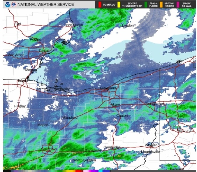
A flood advisory was extended until midnight Saturday for the Shelby region, the National Weather Service reports, marking the second extension of the day.
This covers portions of north central and northeast Ohio, including Ashland, Knox Richland, north Holmes and Wayne counties.
"At 5:23 p.m. EDT, local law enforcement reported continued minor flooding in the advisory area with some county and township roads still closed. Steady light to moderate rain," the weather service said in a statement.
Initially, the flood advisory was to expire at 11:30 a.m. and then 5:15 p.m. Saturday.
LIVE forecast updates: Shelby/Richland County and Huron County region
The flood advisory expired for the New London area.
A flood warning was issued earlier for parts of the region, including within additional areas of Richland County.
"Some locations that will experience flooding include Lexington, Loudonville, Fredericktown, Bellville, Waterford, Butler, Perrysville, Gann and North Liberty," the weather service said.
"As you may know, many roads around the village are closed due to flooding," Bellville police said in a separate social media post Saturday afternoon. "More rain is expected later today. Please be cautious when travelling, flooded roadways are not safe to drive through. Remember, turn around, don't drown!"
Video: drone footage of Bellville flood
A CLOSER LOOK
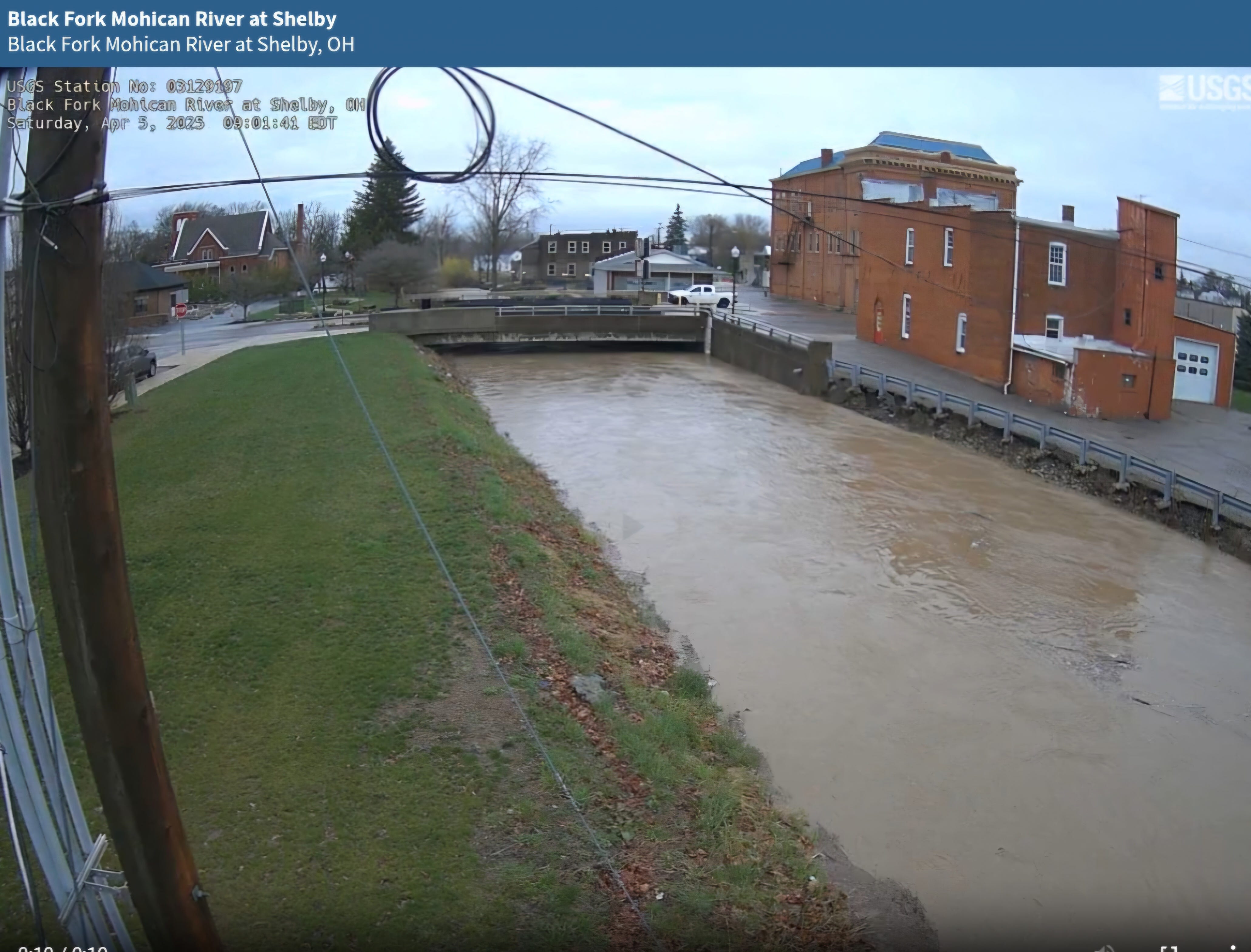
Black Fork River at Shelby (including camera)
Black Fork River at Loudonville
Black Fork River below Charles Mill Dam
Several county roads are closed due to flooding, the Richland County Engineer's Office announced via social media about 11 a.m. Saturday.
The list included:
-- Mock
-- Bellville-Johnsville
-- Bowen
-- Shelby-Ganges
-- London West
-- London East
"Several others with some water over the roadways," the update stated. "Please do not drive through flooded roadways."
At 4 p.m. Saturday, a separate flood warning was issued for Marion and Morrow counties until midnight.
"Numerous roads remain closed due to flooding, especially in the country outside of the city of Marion," the weather service said in a statement. "Expect many areas of slow-moving or standing water. Streams and creeks continue to run high."
Some locations that will experience flooding include Marion, Mount Gilead, Cardington, Prospect, La Rue, Morral, Waldo, Chesterville, Sparta, Caledonia, New Bloomington, Edison, Green Camp, Marengo, Fulton, Iberia, and Shauck, the weather service said.
See details and outlook for the entire region in the National Weather Service’s statements.
Crawford County
On Saturday night via a Facebook post, the Crawford County Sheriff’s Office announced several road closures due to high water:
-- McCurdy Rd/ Stetzer Rd
-- Schwemly Rd/ Lemert Rd
-- Snyder Rd/ Olentangy Rd
-- Brandt Rd. / N Market St Rd
-- Crawford Morrow Line Rd. / State Route 309
-- Stetzer Rd. / Locustgrove Rd
-- State Route 598 / Kile Rd
-- Biddle Rd/ Winchester Rd
-- State Route 98 / Beck Rd
Ashland County
Elsewhere in the region, in Ashland County, a flood warning was in place until 5 p.m. Sunday due to excessive rainfall occurring along the Black Fork Mohican River near Loudonville, the weather service said.
"At 10.0 feet, the river is at bank-full through Loudonville with some low-lying campgrounds near the river seeing inundation," the weather service said. "At 11.0 feet, campgrounds along Wally Road begin to inundate with some evacuations potentially necessary."
The river will crest between 10.5 feet and 11 feet just after midnight Saturday before falling below flood stage late Sunday afternoon, the weather service said.
"Some locations that will experience flooding include Loudonville and Perrysville," the weather service said.
A flood watch remains in place until 8 a.m. Sunday.
REGIONAL TRAVEL: